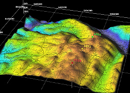
Digital Evaluation Models are images that show differences in elevation which can be used to create models and representations. The DEM above is an image that shows the 3D graphics and multi-layer map that uses these transparencies to point out important characteristics.
No comments:
Post a Comment